Download Image
520.57 KB

ID # 205
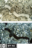
AggrotubuleFrom the Soil Micromorphology Slide Collection
STEM Standard addressed: ESS2E - Biogeology
Appropriate Grade Level(s)
- College-level
- Classroom Lectures
- Laboratory Activities
- Soil Microbiology
Description of slide: The aggrotubule (0.3 mm in diameter) is smooth walled and appears to black a channel. The fecal material (from an earthworm) is mostly silt and clay, has less birefringence than the surrounding fabric. The surrounding RDP is porphyric. The plasmic fabric is moskelsepic.
Data for the horizon
Horizon sampled: 2Bt1
Depth sampled: 52-92 cm
Macromorphological description of horizon: 5 Y 6/2 silty clay loam; 5 Y 7/2 dry;moderate fine prismatic structure; many fine roots throughout; 10YR 4/3 stains on root channels or pores; I0YR 7/2 lime or carbonates on ped faces.
Data for thin section
Preparation of sample: Air dry
Thickness of section: 30 µm
Soil Classification
U.S.: Fine, mixed, thermic Typic Argiaquoll
Legal description: 610 m west and 8 m south of the northeast corner of section 1 4, T23S, RI 5W Physiographic position: Upland
Topography and hill slope position: Shoulder of crested hill; 2% concave, southeast facing slope Parent material: Eolian sands over finer sediments
Soil climatic data and/or soil water balance: Mean annual precipitation 6300 mm, aquic moisture regime
Vegetation: Cropland
Method
Data for 35-mm slide
Magnification: 25 X
Light mode: Plane polarized (BF 1 5); cross polarized (BF 1 6)
Magnification: 25 X
Light mode: Plane polarized (BF 1 5); cross polarized (BF 1 6)
References
Unpublished data from the National Soil Survey Lab, Lincoln NE. Source - W. D. Nettleton
Slides BF15 and BF16. Soil Science Society of America, 1993. A Reference Slide Collection for Soil Micromorphology. SSSA, Madison, WI.
Slides BF15 and BF16. Soil Science Society of America, 1993. A Reference Slide Collection for Soil Micromorphology. SSSA, Madison, WI.
Peer Review: Yes
Credit this item to: SSSAMedia Date: 1993-01-01
Provided By: (SSSA) Soil Science Society of America
Latitude: 38.2017581
Longitude: -99.27855829999999
Author(s)/Creator(s)
-
* Soil Science Society of America
SSSA
Submitted By: (SSSA) Soil Science Society of America
Keywords
- Biological Features
- 2Bt1 horizon
- micromorphology
- Aggrotubule
Comments
Please login to submit a comment.
Log In to your account
Already a member, certified, or existing customer?*
* Cookies must be accepted to log in.
Not sure if you have an account?
Check Your Email
Join Us!
Connect with members and access the information you need.
Learn more.
Ready to Join?
If you have an account, login on the left. Not sure if you have an account or need to create one? Check your email with the link above. We look forward to welcoming you.